Maps, Charts, Lake Photos
This image is from the Rose Township Sesquicentennial map that depicts the land divisions and ownership as they existed in 1837. Residences are shown as small rectangles.
J.C. Clark owns the 40 acres at the southwest of the lake. There is one house, south of where Pellett now intersects with Hickory Ridge.
Since most of this 40 acres is lake or wetland we assume that Clark did not farm here.
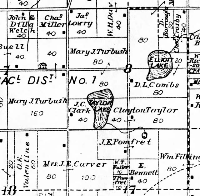
Clayton Taylor owns the 40 acres at the southeast of the lake as well as 80 more acres east of Taylor Lake Road. There is one residence where Tannock now intersects with Taylor Lake Road.
The lake sizes and positions on this map are obviously only approximations based on subjective impressions rather than actual survey. We are surprised that all of the mile and half mile grid roads were already laid out at this time. Only the sub-division roads like Pellett or Tannock are missing. Hickory Ridge had already been run straight through the "useless swamp" instead of around it, which would have taken more of the valued dry land.